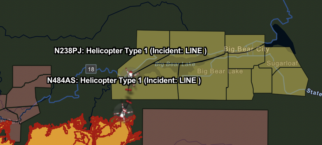
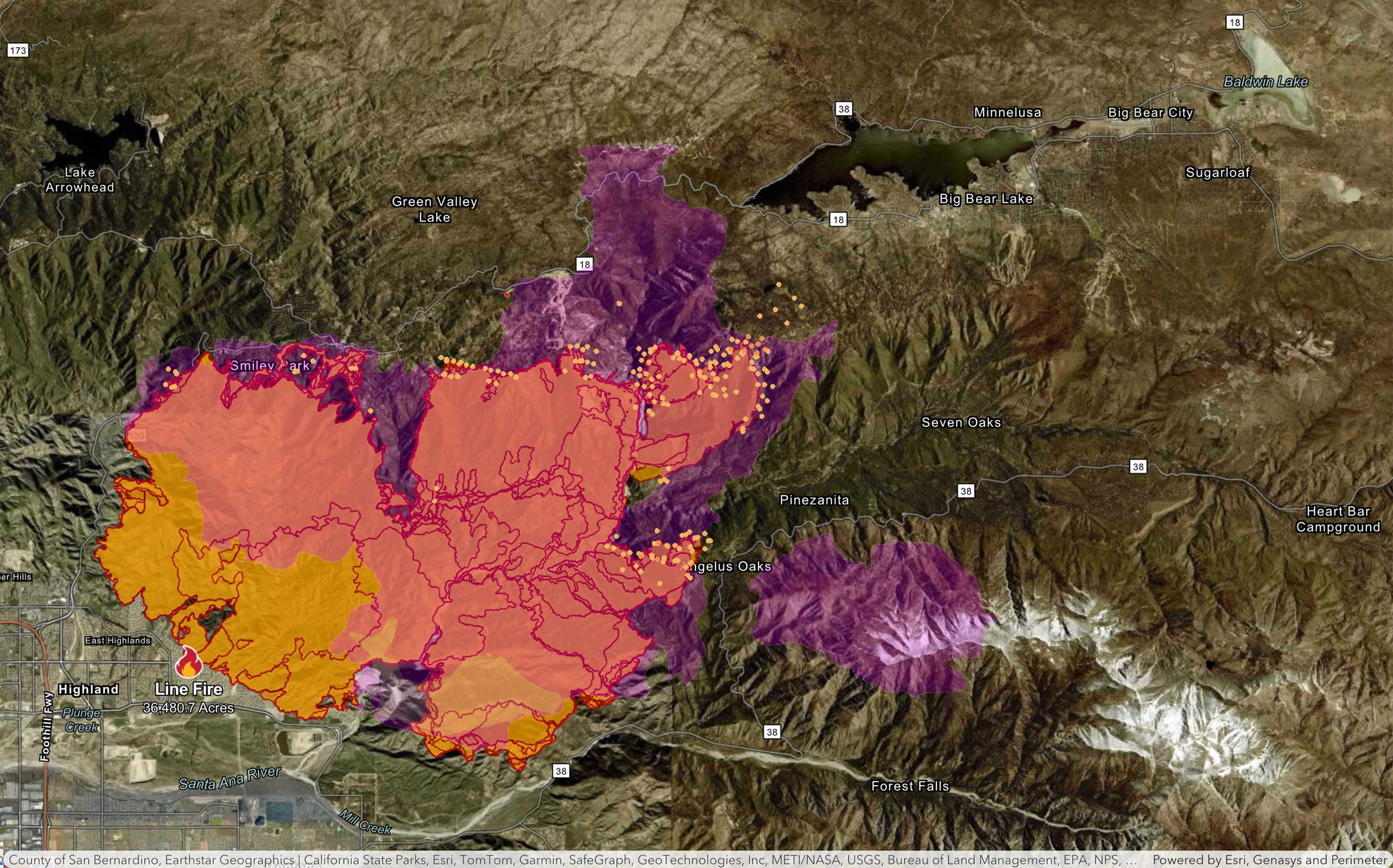
It looks like they either over-estimated the spread to the east yesterday, or perhaps fought it back to the dozer line. The spread into the 38 to the south seemed like a significant update over the last day, however.
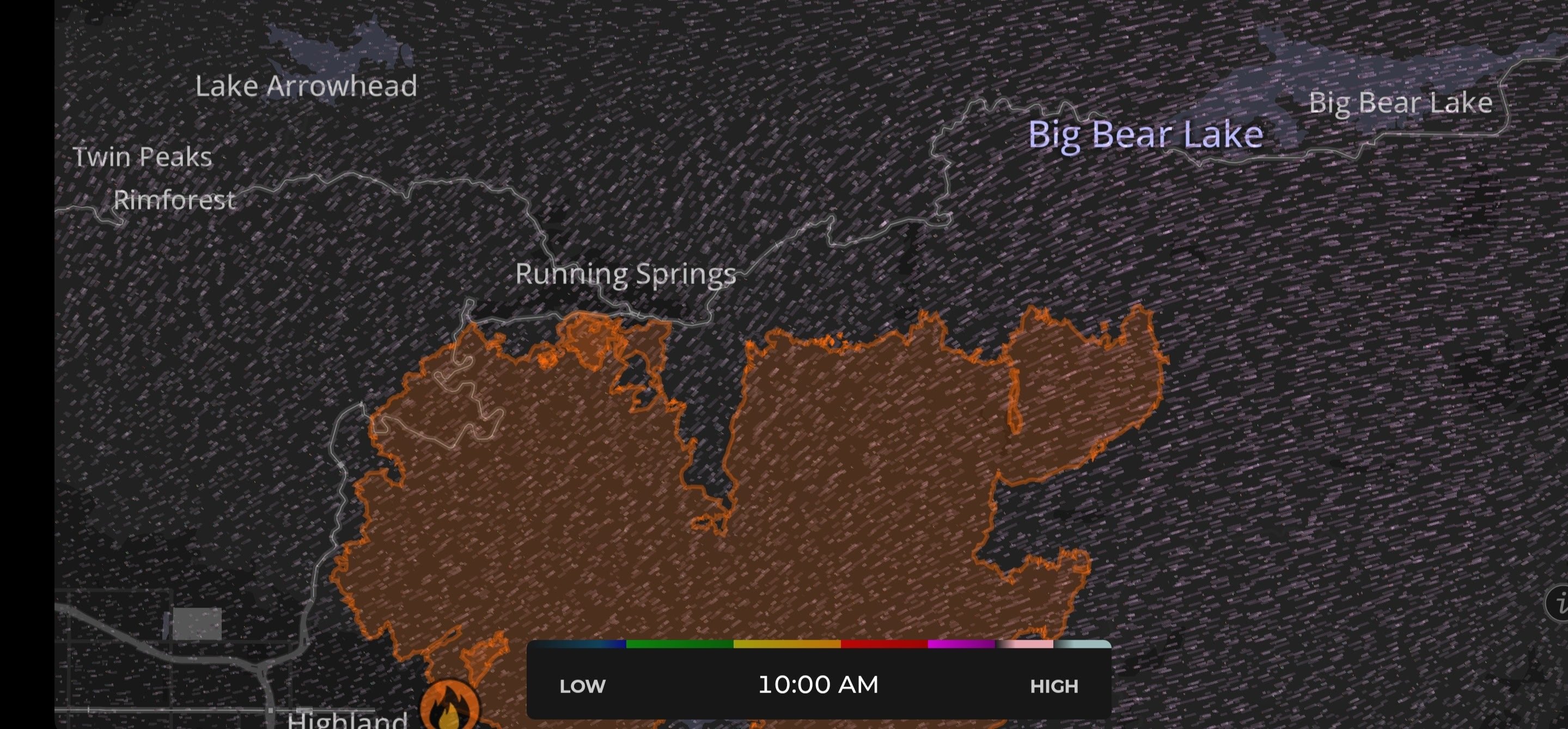
Big Bear residents do have two routes off the mountain right now (either up to the desert in the north, or left to west past Lake Arrowhead), but the 38 is definitely closed for obvious reasons, and the 330 is still closed as well due to the damage the fire caused early on.
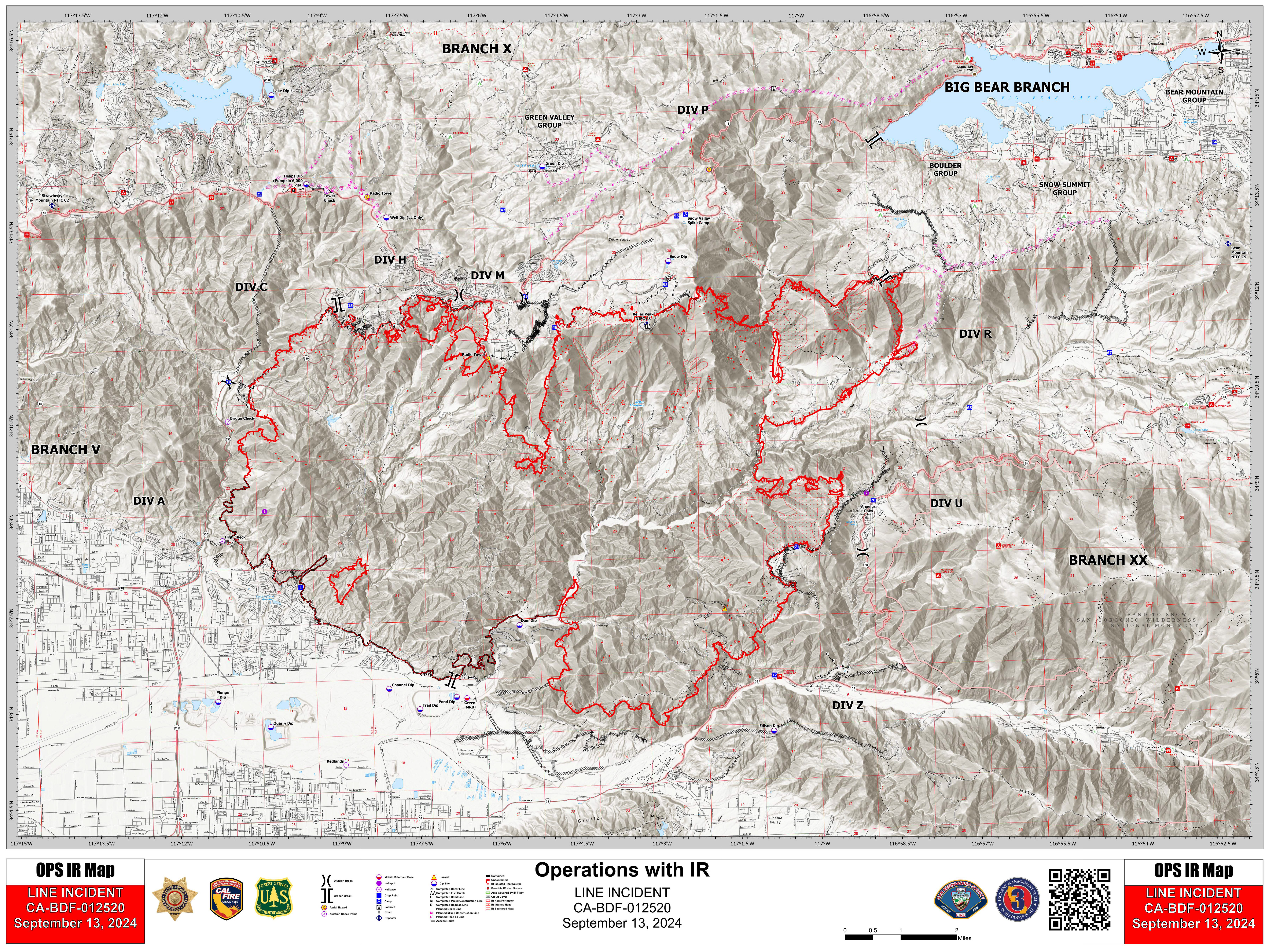
Here's another briefing map. These tend to be updated before the main maps, such as the one on the Cal Fire website. I really appreciate seeing the dozer lines and planned dozer lines as well.

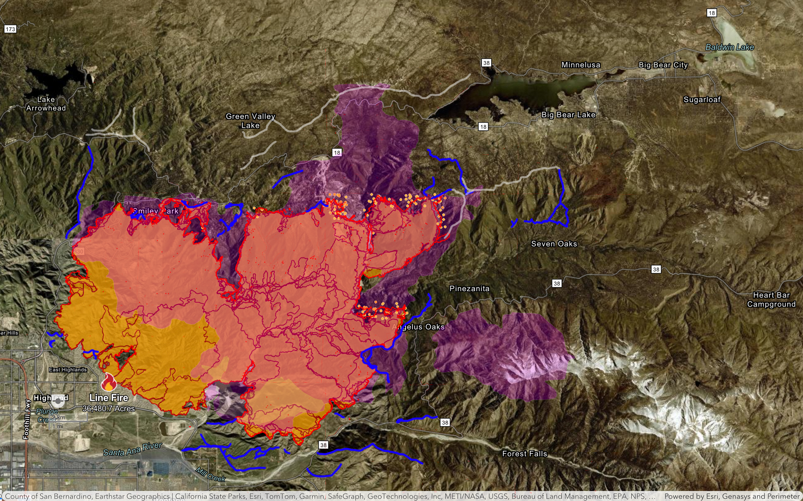
Well, I was hoping I wouldn't have to update this thread again... but the fire has "exceeded expectations" over the last day or two. As such, here is an updated, tactical map showing the barriers being constructed, and the fire's progress.

What's funny is that this is totally a thing here!
https://bigbearromp.com/
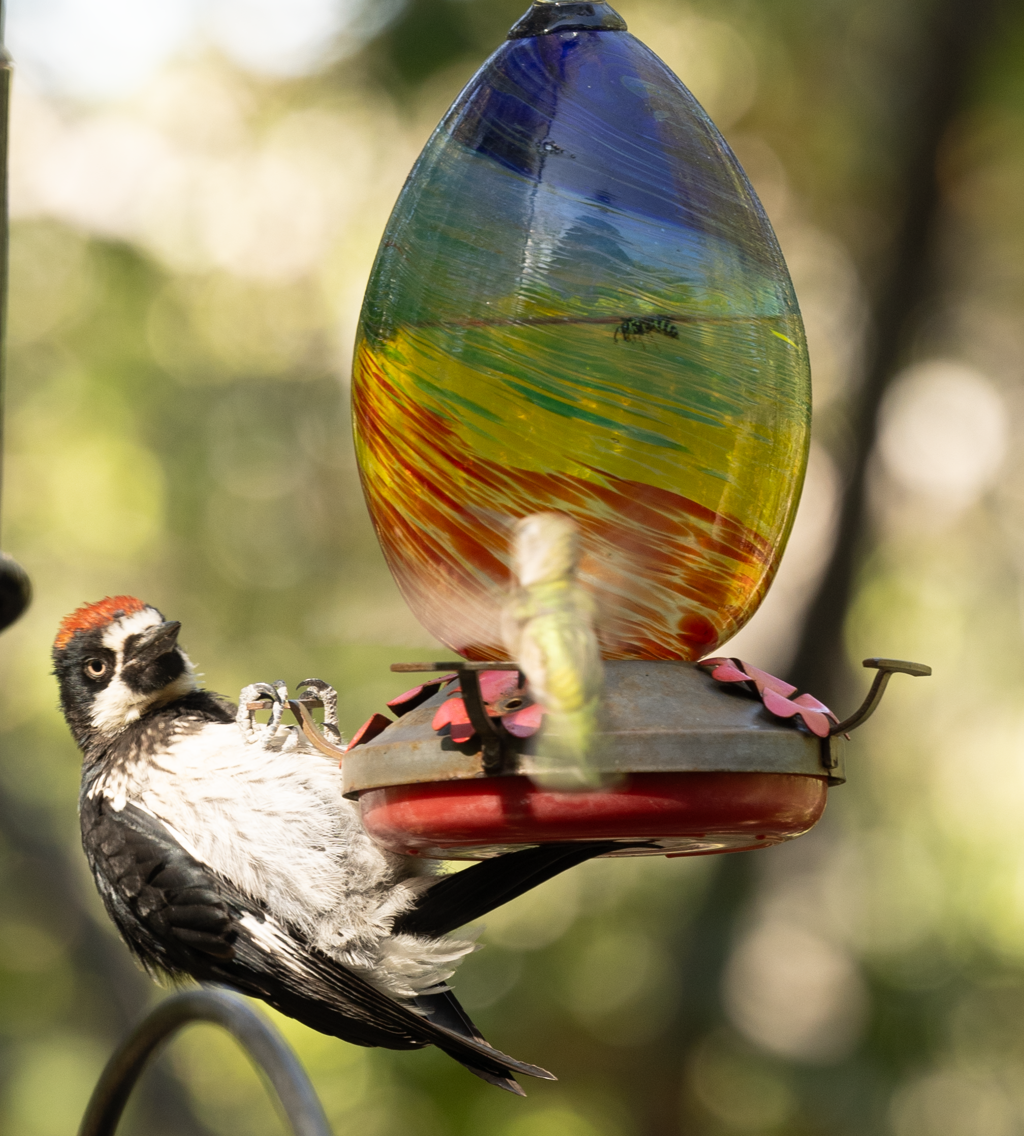
That's really interesting! It does make perfect sense. It's extremely common on my patio to see these guys doing this. In fact, I just got some high resolution images a few minutes ago to add to this post.

This one below is particularly funny, as a feisty hummingbird wanted a turn and they were eying each other.
Cheers to the locals who can come home now! I hope they haven't incurred too much financial hardship if they had to get a hotel and/or miss work. Please double check this as I'm just going by the map, and I haven't seen a statement issued yet.
I did just notice that the area to the left of the Village is no longer under an evacuation order (just a warning). This seems like really fantastic news!
A new Cal Fire video has been posted: https://www.youtube.com/watch?v=QhL53EUrQUg
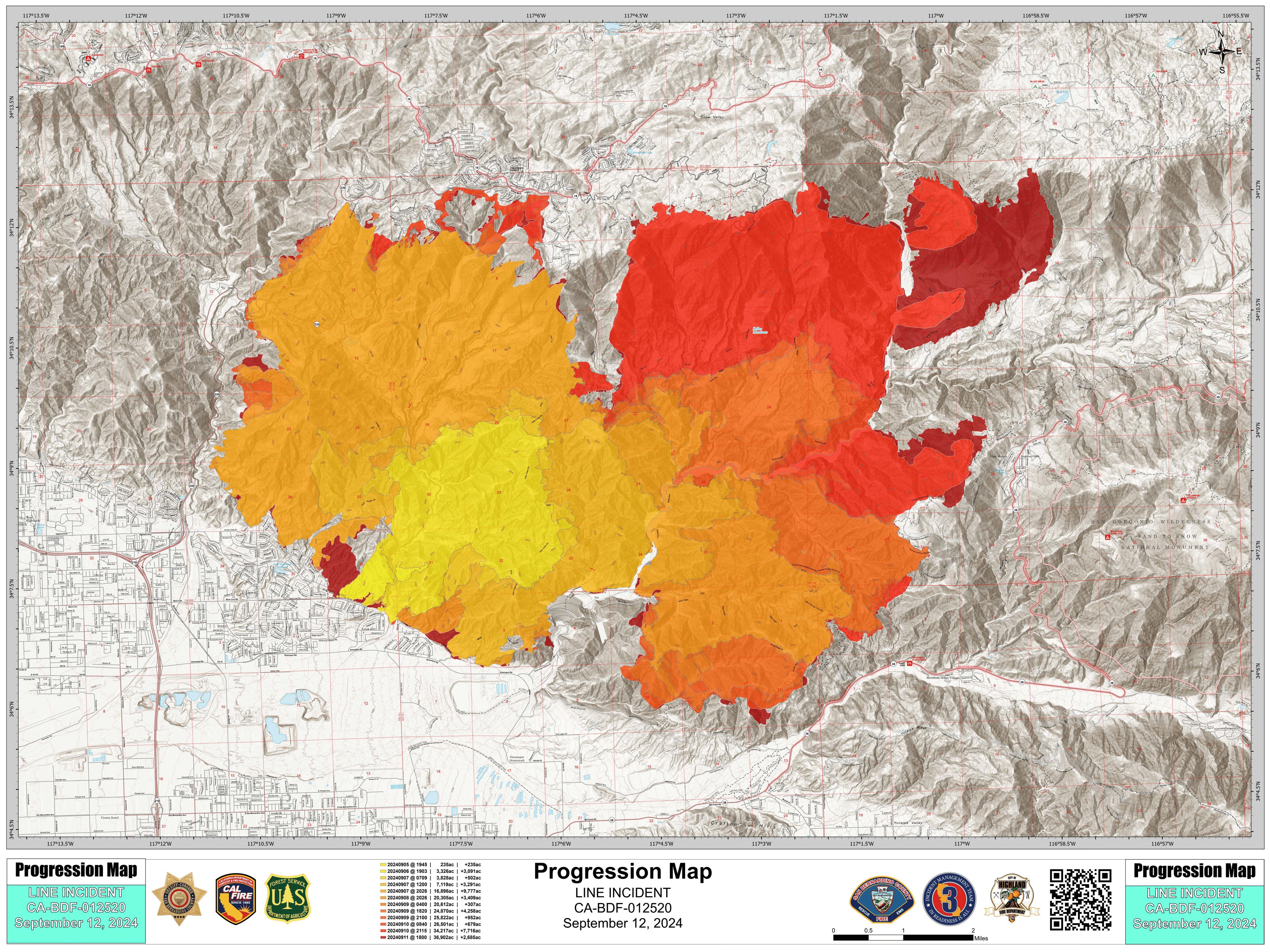
Another quick update: This map is kind of a Frankenstein's Monster combination of four different maps...
The new IR map that's been added was actually skewed (not the exact dimensions of the others), so it is not precise.
- The purple overlay gives us a historic perspective from the 1970's fire
- The red overlay shows a more detailed fire perimeter from the detailed IR Cal Fire Map
- The base map is the primary Cal Fire map for the Line Fire
- The hot spots are from the NOAA satellite map
- The BRIGHT BLUE lines are a rough outline of "dozer lines"
- The TRANSPARENT WHITE lines are planned "dozer lines"
A new Cal Fire video update has been posted (link below starts at the Big Bear section)
https://youtu.be/meio7RFcZvc?feature=shared&t=210
Formatted transcript:
And that will bring us all the way to the edges of our Bear Creek drainage. [The] Bear Creek drainage has been one of the areas that we're really trying to figure out how we're going to deal with. What we've decided is we're going to send Crews down into that Bear Creek drainage, and they'll be cutting it out. It'll be a long process - probably a 5-day event. We'll have helicopter support for them, and we'll have some safety mitigations that will have to take place, but due to the weather for the next seven days, [we're] confident that fir-behavior wise, we can keep this in its footprint with some very slow growth over the next couple of days.
So we're going to take advantage of our weather, we're going to take advantage of the high humidity, and we're going to take advantage of the lack of wind - and we're going to get our crews down in there and cut that whole piece out. It'll be a lengthy process with a lot of people.
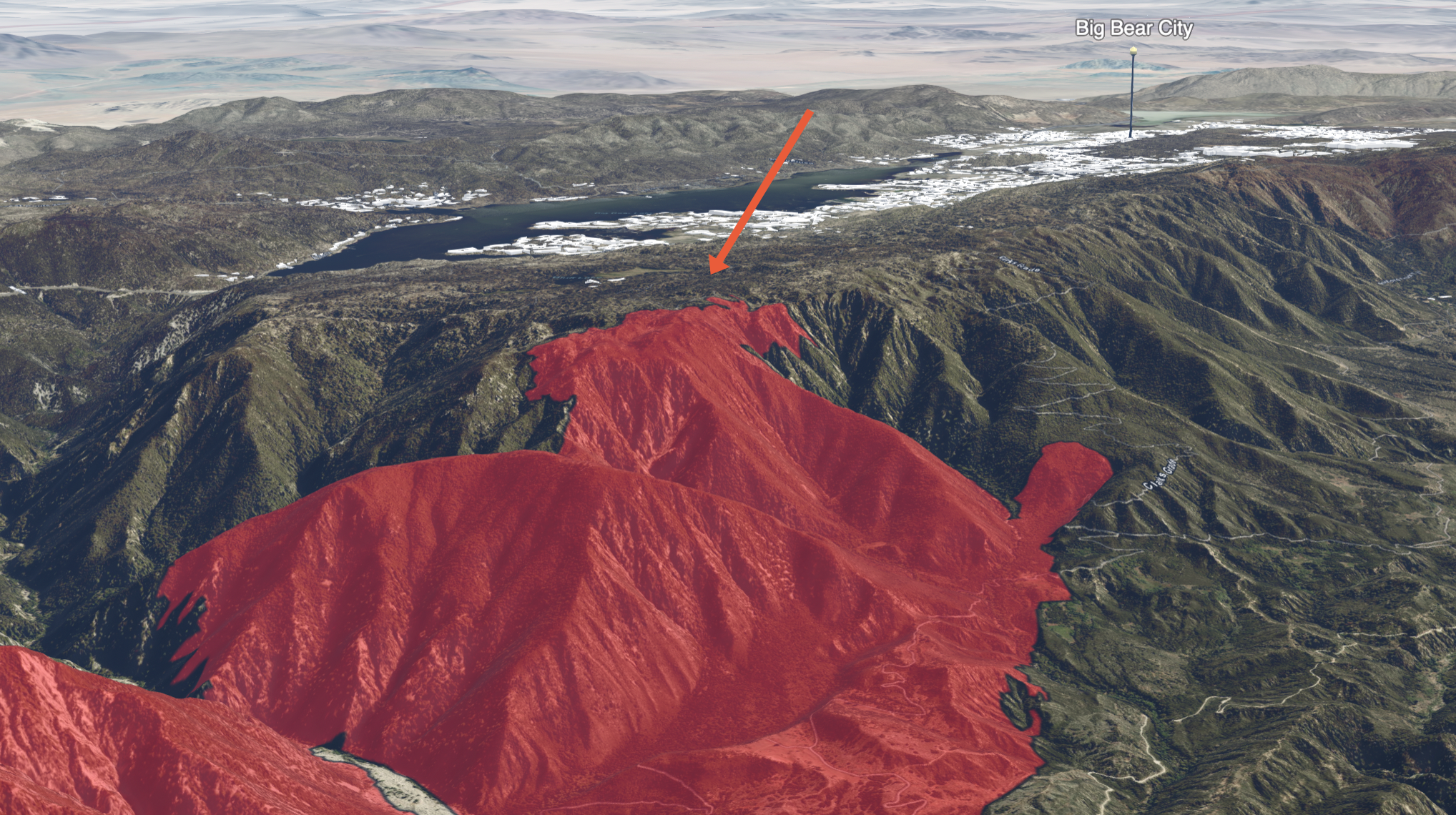
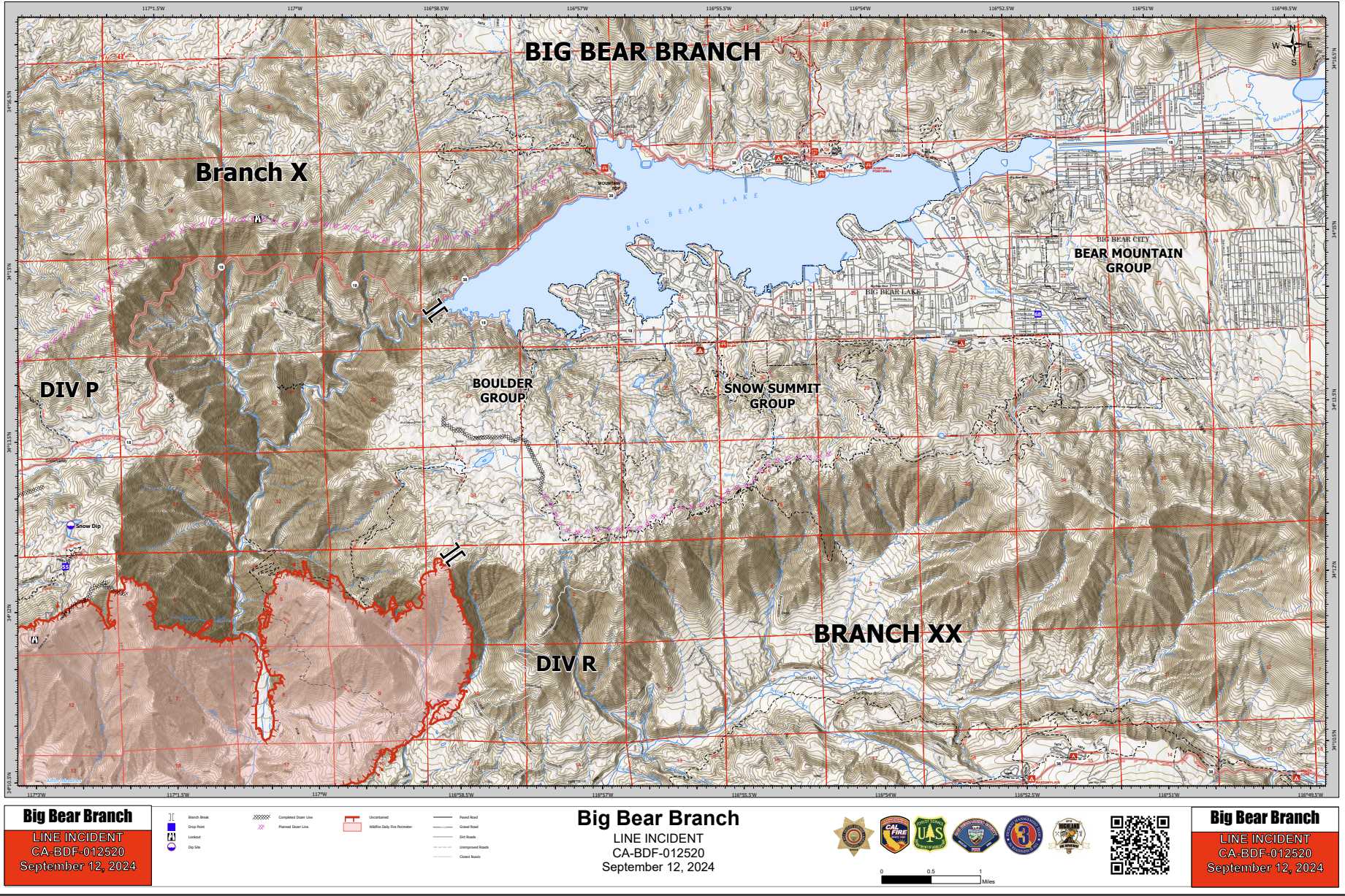
Moving over into the Big Bear drainage, we still have that potential for fire runs up to what we call the plateau, which is right up on the top there where that enormous fuel brake was [created by] the forest service.
[The] fire will creep up and make slope runs up that drainage up to the plateau, and then slop over the plateau. We're pushing Dozer line around that entire Plateau all the way back to the Bear Creek drainage, and then North to the dam.
Once we get to that piece, that should be able to mitigate any of our problems in the Big Bear area. So, the next two or three days will be critical for that operation.**
As we move down off the plateau, and where it says division Romeo into the Clark's Grade area, crews are continuing to improve that line coming down Clark's Grade to the n54 road, and push down into the bottom into the S Oaks Road system, and then move back to the west and tied directly into the fire. Over the next day or so we should have [a] direct line all the way around that entire Eastern flank, all the way back down to the dam, which has been a tremendous progress. [The] next 2-3 days is that critical piece for us to get this entire Eastern section with line around it from the from from Big Bear all the way back down to the dam.
I am fairly certain that this below image I created from the Cal Fire 3D map is "The Plateau" mentioned above:
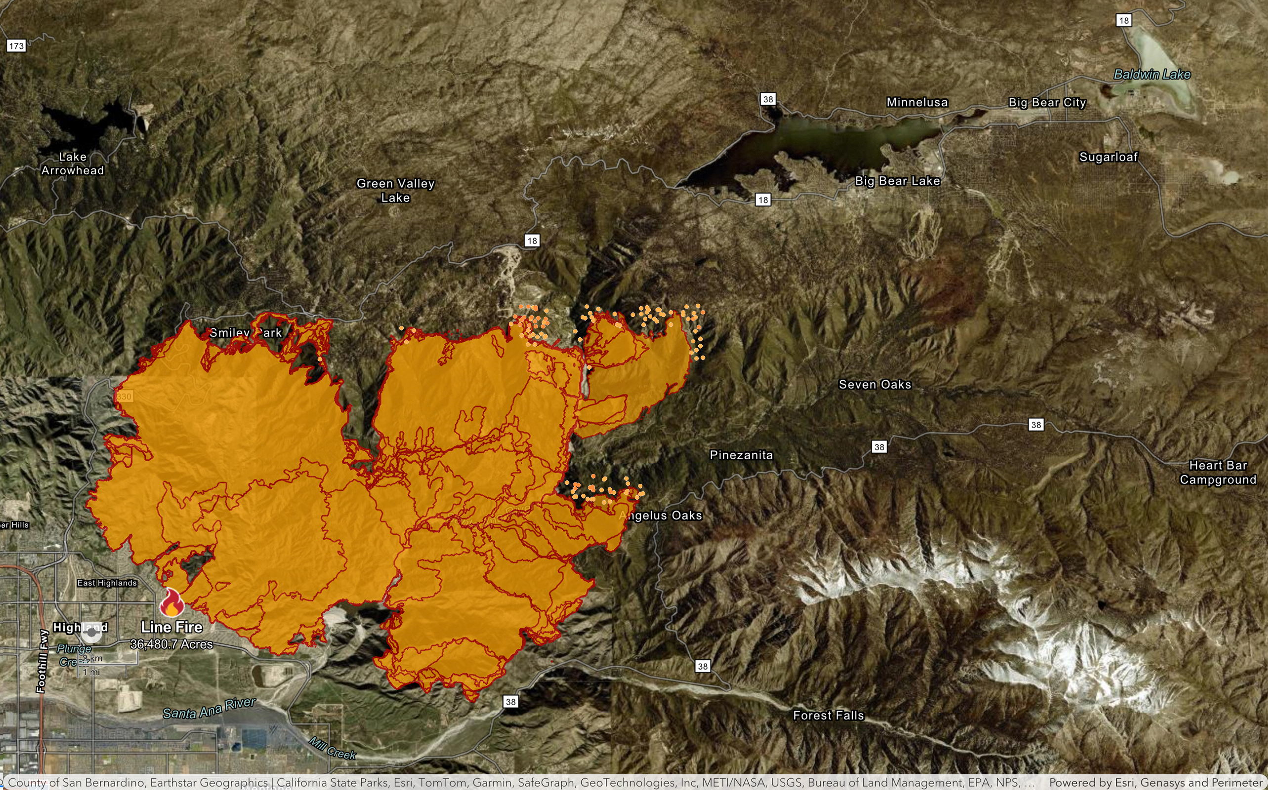
So far, the reports on Big Bear from the Cal Fire officials have been very positive. As such, I wanted to let people know what seemed open in town after I drove to the post office and back. This is as of noon, so they may or may not remain open depending on the air conditions, and fire status.
The idea behind posting this is that these businesses may need some cash flow after this rough week, so I wanted to get the word out.
Nottinghams
Bear Noodle Bar
North Pole Candy Co.
Saucy Mama's
Oakside
Dynasty
Gaby's Latin Flavors
Get The Burger
Moonridge Coffee Company
Most fast food establishments appeared to be open
(but maybe consider supporting local establishments!)
Please let me know if I can expand this list, it is absolutely not a complete list and I may have missed things along the way! I did not drive through Big Bear City, so I can't give a report on that.
Here is an additional, very detailed fire map from this morning (published 9:13 PM PDT) that provides a wealth of information about both current conditions within the perimeter, and also preventative measures and planning.
New fire map for this morning as of 10:16 PM PDT.
This features one with the historic fire data in purple from 1970 (similar fire size and location), and one without.
Both maps combine the Cal Fire map with the Satellite hotspot map from NOAA.

I actually dug this map out of a dropbox archive, I haven't seen it posted anywhere... seems quite detailed! This is from today.
Here is the video report from Cal Fire earlier today, with the link starting the video right when he goes into detail about the current situation on the Big Bear front: https://youtu.be/DEeE4YRbDWI?feature=shared&t=268
Here's an annotated transcription of the Big Bear Portion of the update, which is extremely positive for us:
And then we get into our Big Bear area, and that Big Bear area looks really good. We had the fire come up that slope yesterday. We had about 800 acres burned in that area, [and] it hit what we call the plateau, or the very rim where that vegetation Management program has been put in by the forest service
We had Crews up there waiting and as it hit that Rim, and they attacked it with aircraft, they attacked it with bulldozers, and they're carrying the dozers to the west and then to the north and trying to tie it into the Big Bear Dam Area at the 18 intersection right there. So they'll be doing that today - nursing it along that entire Plateau. As that fire crests that Plateau, [they are] very confident in that operation due to a lot of factors:
- There's some Dozer lines up there
- That vegetation management work that's been done up there and
- The crew's plan worked yesterday, [so] it's going to work again today
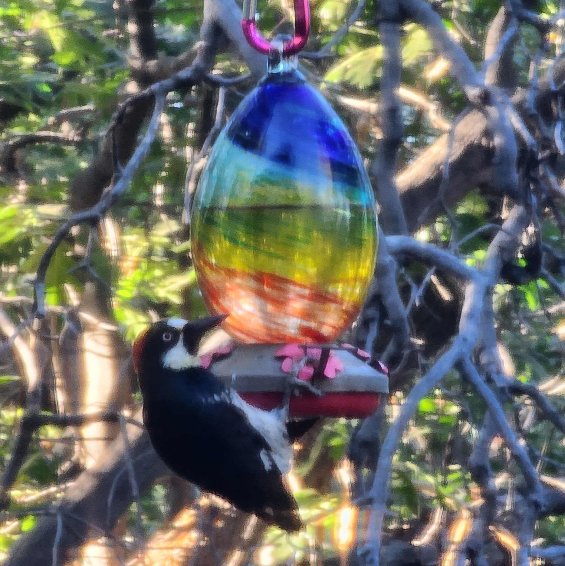
What kind of hummingbird is this?
So these guys are a common occurrence on the hummingbird feeder, and they are well known for this behavior. I believe they are called Acorn Woodpeckers.
When I moved here earlier this year, it was absolutely hilarious to see this behavior. Previously, I've never seen anything but hummingbirds use their namesake feeders.
Edit: I updated the picture with a better resolution version! Original posted image is here: !
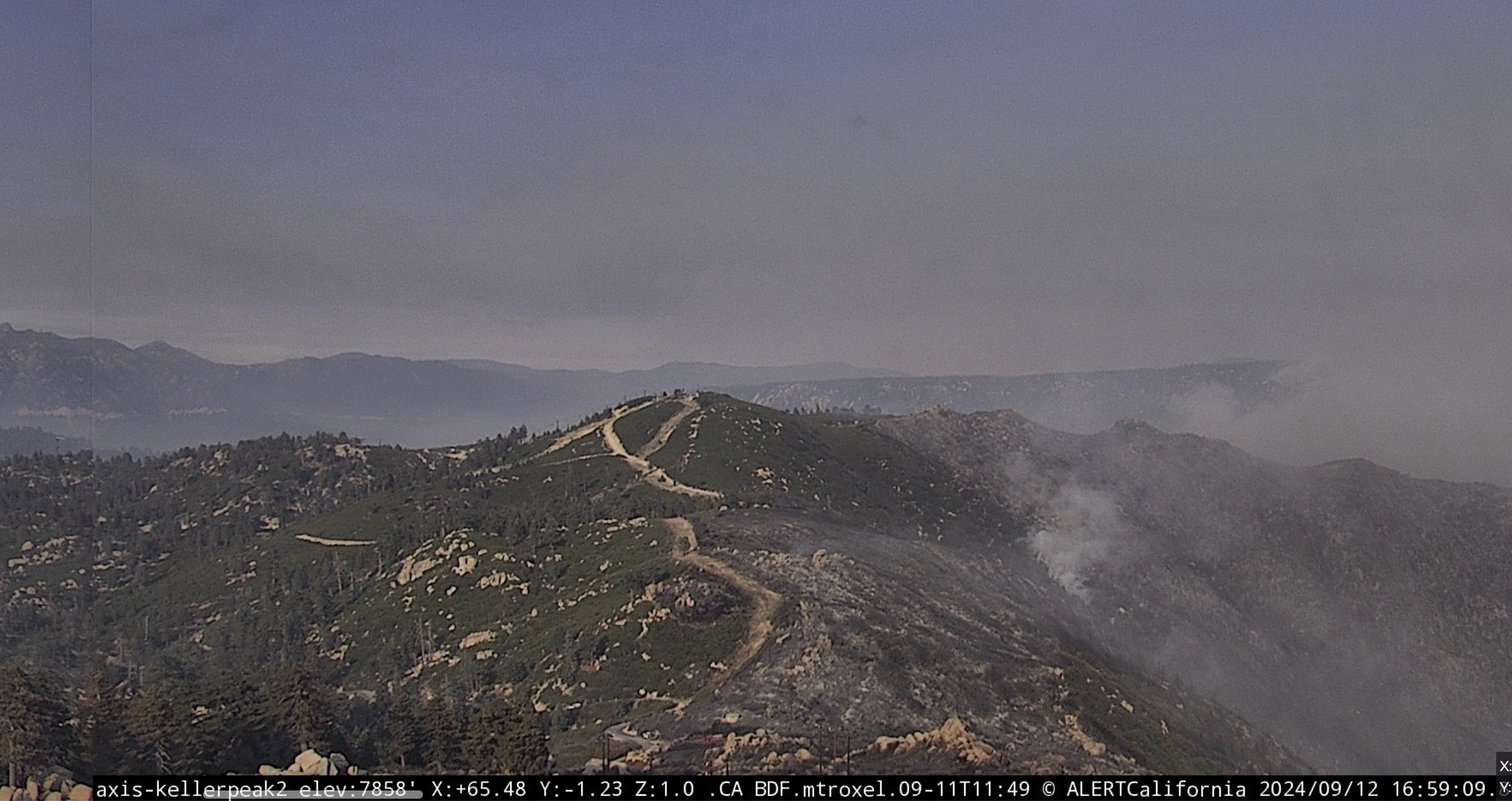
I think we're looking at a visual of a successful border where they stopped the fire. This is looking towards Big Bear from Keller Peak at 4:59 PM PDT. It certainly seems promising! Live Cam: https://ops.alertcalifornia.org/cam-console/2045
I doubt this is new news, I just didn't notice it until now and figured it was a positive update to share.
So, I haven't seen an update all day with regards to the maps... This is very abnormal compared to the last week, but not necessarily bad news.
In the good news category, this is the cleanest air day I've seen so far all week. The PM 2.5 count was over 800 for most of last night, up until about 1AM when I noticed the stars were visible. Today has been really nice, though... 50-100 at the start, and it's down to 15-20 right now.
There's a distinct lack of wind here, and (judging by the wind map on MyRadar) over the fire right now. This seems like great news when paired with this being the coldest day since the fire started.
Aha! Three people now, it's officially a party. I think this page is being lurked by more than that based on the Reddit updoots, but it's pretty hard to tell haha. Let me know if I can improve anything in the top post!
Not the best news today first thing with this map, but hopefully the firefighters are able to tackle those hot spots near Bluff Lake. Update as of 10:45PM PDT (but those hot spots crawling north were from at least an hour earlier).

Line Fire Resources
I wanted to put together a hub of resources for the Line Fire here on Lemmy. I hope this helps anyone who might find it!
⚠
Sort by NEW to see the latest maps/updates!
🗞
Line Fire Updates:
https://www.fire.ca.gov/incidents/2024/9/5/line-fire/updates The latest updates from the county and state are funneled through here multiple times a day.
🗺
Line Fire Maps:
The latest maps are being curated in the comments below multiple times a day, but the most up-to-date maps should always be the direct sources listed right here:
NOAA fire Map: https://www.ospo.noaa.gov/products/land/hms.html#maps The most reliable and frequently updated map that shows satellite readings of fire spread. This includes hotspots outside the perimeter, and a comprehensive smoke plume map.
Official Cal Fire Map: https://www.fire.ca.gov/incidents/2024/9/5/line-fire Shows live aircraft positions, and is updated a few times a day. Very reliable and helpful to review evacuation warnings/orders
3D Fire Map by Cal Fire https://calfire-forestry.maps.arcgis.com/home/webscene/viewer.html?webscene=52683f25df174b0eb124dfb9a6831a98 Not updated more than once or twice a day, but a very cool map to inspect.
CleanAir Fire & Smoke Map https://fire.airnow.gov/#10.64/34.2049/-116.9408 Updated more often than the Cal Fire map, and shows real-time air quality readings
Historical map of the Big Bear area https://projects.capradio.org/california-fire-history/#10.76/34.1852/-116.9961/0/1 This is an extremely helpful tool for obtaining visual data of previous wildfire events. The linked map is centered on Big Bear and Arrowhead lake.
📹
Line Fire Webcams
https://ops.alertcalifornia.org/cameras This network of cameras can be used to easily and intuitively view the fire from multiple angles.
📻
Line Fire Radio
https://scancalifornia.com/live/goldmine/ This covers radio chatter from firefighters tackling the Line Fire.
💬
Community Resources
https://socalmountains.com/e107_plugins/forum/forum.php A forum for locals that's been around since 2003
Local Images
https://www.flickr.com/photos/calfire/albums/72177720320272950/with/53989492937
Big Bear City trash pickup was halted on Tuesday, Wednesday and Thursday of this week. Water and Sewer services are all continuing without disruption. (and I haven't personally experienced any power disruptions yet.)